


Regional Geological Investigation
To carry out the regional geological investigation and comprehensive research in the major metallogenic belts, major economic zones and key infrastructure construction areas and major geological issue zones at 1:50,000 and 1:250,000 scale of international geological map division. The basic geological survey and comprehensive researches of Qinghai-Tibet Plateau, Tianshan Mountain-Xingmeng orogenic areas have been carried out in succession. The geologic structure regionalization of China and regional geological survey have been integrated together in one program.
Regional geophysical and geochemical exploration and remote sensing in geology
To mainly carry out the geological survey of regional gravity, airborne magnetic, regional geochemical exploration and remote sensing in geology in the metallogenic belts at 1:50,000 and 1:250,000 scale. On the basis of regional geological investigation, the comprehensive investigation of urban geology, multipurpose ecological geochemistry (agro geology), geoheritage, mine monitoring and land and resources by using remote sensing technology have also been conducted.
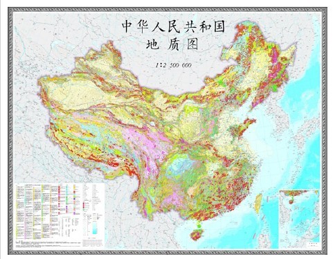
China geological map
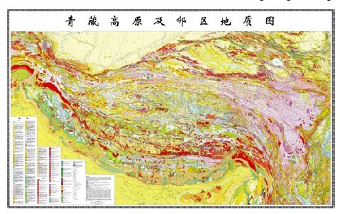
Geological map of Qinghai-Tibet Plateau and its adjacent areas