


Achievements
Top8. Remote Sensing Monitoring of Mines Covers China’s Whole Continental Area for the First Time
Using
advanced remote sensing technology and organizing 24 units from all over the
country to work together, CGS has completed the remote sensing interpretation
of suspected illegal mining activities for the first time, discovering more than
6,000 suspected illegal mines. We have also systematically accomplished the comprehensive remote sensing survey and
monitoring works for the investigation of mineral resources development and
utilization status, the geological environment of mines and the implementation
of the mineral resources plan, providing important technical support to the nation-wide
program of using the satellite image to conduct the law-enforcement inspection
of mining activities.
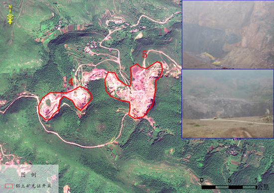
Remote Sensing Survey Map showing Unlicensed Bauxite Mining