2013 Top 10 Geological Survey Progresses
Top6. Important periodical results were achieved from geological environmental survey of important economic zones and urban agglomerations
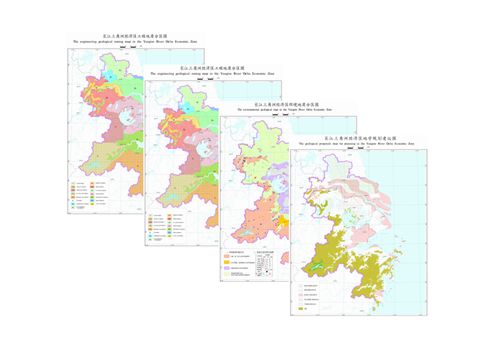
Since 2009, China has been pushing forward the geological environment investigation of important economic zones and urban agglomerates, covering the 6 important economic zones including the around-Bohai Sea, Yangtze River delta, Pearl River delta, west side of the Straits, Beibu Gulf and Changchun-Jilin-Tumen areas, and 4 important central and western city agglomerates including the mid-Yangtze, Central Plains, Central Shaanxi Plain and Chengdu-Chongqing agglomerates. After 4 years of hard work, we managed to complete 1:250000 regional-scale geological environment investigation, systematically assessed the regional tectonics, topography, hydrological geology, engineering geology and environmental geology, delineated the distribution of main environmental geological concerns, conducted carrying capacity on resources and environment, compiled series geological maps on the scale of the 1:250000 and provided geoscience recommendations concerning the regional economic and social development planning. The outputs of the project provide important geoscience base data for the planning of main functional regions, optimization of the spatial land distribution, new urbanization, industrial structure adjustment, optimal resource configuration and the construction of major projects.

Geological environmental map on the large scale of 1:250000 of the Yangtze River delta economic zone


