


2013 Top 10 Geological Survey Progresses
Top10. UAV aerogeophysical (magnetic/radioactive) survey was a game changing innovation both in and out of China
Based on the Rainbow-3 medium UAV platform, we integrated and developed the first UAV aerogeophysical (magnetic/radioactive) station in the world, broke through the ultralow flying control, terrain following and obstacle avoidance techniques for UAV, created remote survey-control programs and UAV-based magnetic compensation method. Trial production of the aerogeophysical (magnetic/radioactive) survey system in Duobaoshan, Heilongjiang Province indicated significantly higher control of both the average yaw and average flying height than conventional aerogeophysical survey. The result proved high quality and implemented night flight detection in the trial production. 5 of the 7 flights implemented night flight detection with the maximum working hours per day of 13h, which significantly improved the flying efficiency. The trial production demonstrates that the UAM expertise has the merits of safety, efficiency, flexibility and low cost. It will provide a new weapon for geological survey.
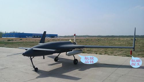
Rainbow-3 UAV aerogeophysical (magnetic/radioactive) station
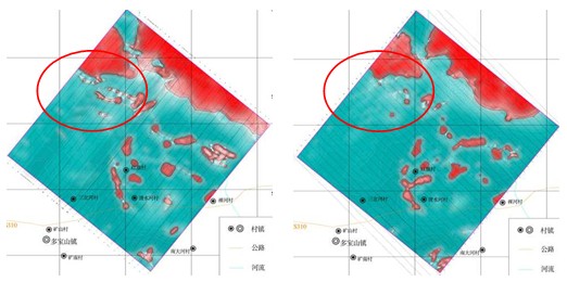
1:10000 aeromagnetic survey result of Duobaoshan Area UAV (left) vs the conventional (right)