Golmud-Lhasa Railway Geological Survey
SLIP-RATE OF THE WEST BOUNDARY FAULT OF THE WENQUAN GRABEN
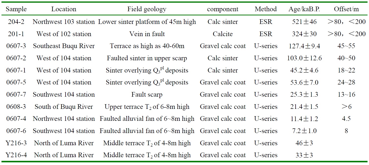
The Wenquan graben is located north of the Tonggula Mts. and its east dipping west boundary fault controls formation and evolution of the Wenquan basin. It formed part of a large-scale basin and range tectonics in the northern Tibetan Plateau during Quaternary (Fig.9). The west boundary fault dislocated Jurassic sandstone and limestone of Yanshiping Group, cut Middle-Late Pleistocene alluvial and fluvial fans and formed piedmont terraces overlain by sinter cones and sinter ridges in geothermal fields. Fault scarps rise above the fault are 70m, 40-50m, 20-26m, 11-15m, 8m and 4-5m from earlier to younger stages (Table 4).
At least 3 intense earthquakes occurred in Holocene along west boundary fault of Wenquan graben, to form 3 episodes of scarps and fractures filled with mixtures of sand and gravel (Fig.9). Vertical slip-rate of the west boundary fault ranges from 0.3mm/a to 1.1mm/a with an average rate of 0.6mm/a in Late Quaternary.
Table 4 Age of deposits and offsets along the west boundary fault of Wenquan graben


Fig.9 Geological and tectono-geomorphic features of west boundary fault of Wenquan graben


