


Achievements
THE EXTENT AND BEHAVIORS OF SEAWATER INTRUDING AROUND JIA-HE, YANTAI CITY, SHANDONG PROVINCE
Jiang Zhen-quan1, Yao Pu1,
Liu Wei –jin2, Wang Jing2
1 School of Resources and Earth Science,China University of Mining and Technology,Xuzhou Jiangsu 221008,China;
2 Monitoring Station of Geological
Environment of Yantai, Yantai 264025,China
Abstract: The groundwater along the coastal and valley areas of Jia-he has been intruded by seawater in the early 1980s. Base on the series of monitoring data of the groundwater quality after 1985, which come from 11 typical well points, the seawater intruding degree is interrelated generally with the dynamic variation of groundwater and is controlled mainly by the dropdown extent of groundwater in the intruded area. In view of the characteristics of groundwater quality along Jia-he River valley, this paper evaluates the extent and behaviors of seawater intruding by the fuzzy comprehension evaluation according to vicissitudes of five hydro-chemical indexes including Cl—, M, SO42—,rHCO3/rCl and SAR of three different periods (1994, 1999 and 2004). The evaluating results indicate that groundwater quality continues deteriorating following groundwater level declines year by year in the intruded severely areas where water level is in negative value, whereas intruded grade of groundwater is in a lower degree for long term outside the areas.
Keyword: Yantai City, seawater intruding, groundwater drawdown, fuzzy comprehension evaluation
1 Preface
The seawater
intruding areas of Yantai city are mainly centralize on the coastal plains and
Jia-he river valley belonging to mountain front alluvial plain and coastal
plain in the geomorphy where the altitude is about 5~10m and gradient of
ground surface is less than 1‰. Because of
abundant in fresh water deposits and in groundwater supplying , the
pore water has been drawn in quantity for productive use and daily life use
after the medium-term of 1970s, which storing in the middle and upper aquifer
formed in Holocene and middle-upper Pleistocene and composed of fine-medium
particle sand, silt and sand-gravel and so on.
2 Basic Situation
of Seawater Intruding around Jia-he River Valley
2.1 Basic situation of seawater intruding
Base on the
hydro-dynamic and hydro-chemical monitoring data from 11 well points
around the seawater intruding area since the middle of 1970s, the range
where content of Cl—in groundwater is
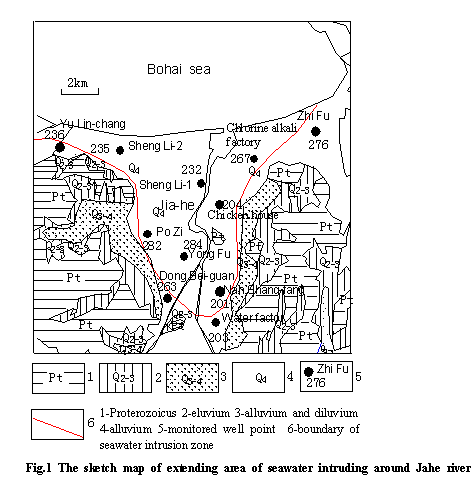
up to 250mg/Lenlarged gradually along the Jia-he river valley after 1985, and
the area of seawater intruding shown in Fig.1 formed in 1990 which
acreage reached 47.87 km2 and extended
southward 8.93 km up to Xi-mu, Ren Jia-shan.
2.2 Process of seawater intruding
The groundwater
along the Jia-he river valley is the important water recourse for Yantai city.
The original hydro-dynamic balance of seawater and freshwater was destroyed
because of over exploited of groundwater. Base on the monitored data of
groundwater quality for 58 well points, groundwater near the coastline has been
markedly intruded by seawater in the early 1970s, and then the intruded region
extended up Jia-he river along the valley year by year, and general outline of
the seawater intruding area formed at the end of 1985s.
Characteristics of seawater intruding are enslaved to the dynamic condition of groundwater, and intruded degree is correlated with the decline extent of groundwater level. Monitoring results of groundwater quality for long time indicate that the intruded areas seriously occur mostly in the negative zone of the water level and intrusive degree is aggravated with lowering of the water level. On the other hand, seawater intrusive degree is slight relatively outside there, and water quality holds relatively stabilization all the time, even becomes better in the particular areas.
2.3Time-spatial evolvement characteristics of hydro-chemistry of groundwater in the seawater intrude areas
The hydro-chemical character of the groundwater is important evidence to Judging the seawater intruding. It is most case to analysis the seawater intruding depending on single index thus far, and generally to consider that Cl-concentration is more than 250mg/L in groundwater to be the symbols of mixed with seawater. However, in process of seawater intruding, hydro-chemical evolvement of groundwater is variety and is influenced many factors which relate to the intruded degree. In view of primary and secondary relationship among factors varying with area and time, it is difficult in technique to appraise hydro-chemical evolvement considering all factors.
To be capable of reflecting truthfully evolvement characteristics of the intruded groundwater quality of the Jia-he area, this paper analyzes hydro-chemical characteristics of groundwater in process of seawater intruding according to the variations in 5 hydro-chemical indexes such as Cl-、M、SO42-、rHCO3/rCl and SAR (table 1)of rainy season in different time(1994、1999 and 2004)by fuzzy comprehension evaluation method, based on the monitor data from 11 sites around the seawater intruded area which have been monitored continuously since 1980.
Table 1The statistic of hydro-chemical characteristic indexes for each monitored points in different period
|
Monitoring sites and location Location Evaluating years and indexes |
201 |
203 |
204 |
232 |
235 |
236 |
263 |
267 |
276 |
282 |
284 |
||
|
NanShang-fang |
Water factory |
Chicken house |
Shen Li-1 |
Shen Li-2 |
Yu Lin- chang |
Dong Bei-guan |
Chlorine alkali factory |
Zhi Fu |
Po Zi |
Yong Fu |
|||
|
1994 |
Cl—(mg/L) |
259.3 |
201.2 |
202.1 |
3756.5 |
692.3 |
218.9 |
125.4 |
77.6 |
114.1 |
296.4 |
416.3 |
|
|
SO42—(mg/L) |
74.4 |
141.7 |
201.7 |
441.9 |
379.4 |
79.2 |
132.1 |
69.6 |
52.8 |
52.8 |
345.8 |
||
|
M(mg/L) |
775.4 |
666.4 |
1051.7 |
7084.6 |
2369.2 |
741.9 |
1075.2 |
407.3 |
1030.3 |
895.8 |
1764.8 |
||
|
rHCO3/rCl |
0.446 |
0.60 |
0.77 |
0.05 |
0.42 |
0.96 |
2.01 |
0.86 |
2.75 |
0.56 |
0.26 |
||
|
SAR |
4.59 |
0.29 |
3.22 |
30.68 |
24.43 |
1.39 |
1.80 |
1.66 |
1.79 |
2.86 |
3.24 |
||
|
1999 |
Cl—(mg/L) |
278.2 |
109.1 |
- |
241.8 |
647.3 |
74.9 |
77 |
1369.6 |
264.2 |
315.6 |
307.1 |
|
|
SO42—(mg/L) |
232.9 |
104.8 |
- |
239.9 |
109.5 |
54.5 |
114.1 |
633.5 |
159.3 |
48.9 |
230.6 |
||
|
M(mg/L) |
935.6 |
525.8 |
- |
1208.3 |
1677.5 |
398.7 |
971.6 |
3306.6 |
1202.2 |
1123.7 |
1611.7 |
||
|
rHCO3/rCl |
0.24 |
0.74 |
- |
0.81 |
0.30 |
0.21 |
3.35 |
0.07 |
0.87 |
0.45 |
0.79 |
||
|
SAR |
3.06 |
1.98 |
- |
5.29 |
12.50 |
1.00 |
1.57 |
10.84 |
2.05 |
3.07 |
4.92 |
||
|
2004 |
Cl—(mg/L) |
167.8 |
73.1 |
54.6 |
145.0 |
2464.3 |
115.1 |
155.6 |
1881.5 |
136.1 |
607.7 |
542.4 |
|
|
SO42—(mg/L) |
216.1 |
93.9 |
93.2 |
167.9 |
90.6 |
109.1 |
114.4 |
491.5 |
128.0 |
98.4 |
323.5 |
||
|
M(mg/L) |
1085.7 |
472.1 |
445.5 |
981.3 |
5379.7 |
714.2 |
742.0 |
4113.0 |
753.6 |
1400.7 |
1986.2 |
||
|
rHCO3/rCl |
0.88 |
1.03 |
1.20 |
0.85 |
0.19 |
0.91 |
0.59 |
0.09 |
0.73 |
0.22 |
0.29 |
||
|
SAR |
1.96 |
1.58 |
0.86 |
2.51 |
31.6 |
1.38 |
1.46 |
16.02 |
10.74 |
4.35 |
4.74 | ||
Remark (-): lack of original monitored data
3 General Appraisement of Seawater Intrusive Degree
3.1 Evaluation factor
In respect that Cl— is a main component of seawater which is convenient for testing and an earmarked index of signifying whether seawater intrude into groundwater, it is used usually as a preferred index for evaluating seawater intruding. M (mineralized degree) is a hydro-chemical index to indicate salinity in water. Because of the clear contrast between seawater and freshwater in M, degree of seawater intruding can be made certain according to the M content of the groundwater. SO42- is also a hydro-chemical index varying sensitively with water quality[1、2]. The natural groundwater has a low SO42- content In the region along Jia-he river that is often under 20mg/L and far lower from seawater, and seawater intruding results in becoming obviously higher of content of SO42-in the groundwater. The other evaluation factor is rHCO3/rCl expressing the content ratio of HCO3- to Cl-(r represents milligram equivalent). Recent research indicates that the disparity in the ratio between seawater and groundwater reaches generally hundreds times. Forming a striking contrast to have high Cl-content in seawater, the main anion in groundwater along Jia-he river valley is HCO3- with the concentration of general from 150 to 200 mg/L, the difference in intruded degree would correspond with the amount of rHCO3/rCl[3]. Being similar to rHCO3/rCl, SAR (sodium adsorptive ratio) expressed as  in which letter “r” represents milligram equivalent is sensitive to change in water quality. Standing in vivid contrast against the groundwater in which principal cation is Ca2++Mg2+, seawater have high Na+ content which is higher 2~4 orders of magnitude to the groundwater. The SAR of groundwater would increase clearly if it was intruded by seawater, and magnitude of the SAR associates generally with intruding degree in seawater intruding areas.
3.2 Quantify of ingression degree
This paper grades the intrusive degree according to groundwater quality characteristic of the ingression area (table 2)
Table 2 Grading seawater intrusive degree
|
Grade |
Ⅰ |
Ⅱ |
Ⅲ |
|
Intrusive degree |
Slight |
Moderate |
Serious |
|
Water quality |
Freshwater |
Slight saltwater |
Saltwater |
The difference in gustation of water associates principally with the concentration of Cl-. One can taste obviously salty in the case that content of Cl- is up to 200~300 mg/L in water, therefore it generally is used as the limit value for distinguishing between freshwater and saltwater. The water- quality standards of Chinese such as sanitary standard of drinking water (GB5749-85) and water- quality standard of agricultural irrigation (GB5084-92) all qualify the content of Cl-within 250 mg/L . Based on the water quality standards of Chinese and consulting the academic points of view about quantifying degree of seawater intruding[3-5], this paper adopts 250 mg/L and 1500 mg/L as lower limit value for respectively brackish water and saline water, and supplies the lower limit values of other four factors for quantifying water quality according to the correlation between them and Cl- [6, 7] (table 3)
Table 3 The rank of the indexes for judging the seawater intruding and its representative value
|
Index |
Ⅰ |
Ⅱ Ⅲ |
Ⅲ |
|||
|
interval value |
representative value |
interval value |
representative value |
interval value |
representative value |
|
|
Cl—(mg/l) |
<250 |
100 |
250-1500 |
600 |
>1500 |
2200 |
|
M (mg/l) |
<1000 |
500 |
1000-3000 |
2000 |
>3000 |
3500 |
|
SO42—(mg/l) |
<200 |
75 |
200-1200 |
500 |
>1200 |
1800 |
|
rHCO3/rCl |
>0.655 |
1.00 |
0.655-0.08 |
0.25 |
<0.08 |
0.02 |
|
SAR |
<2.00 |
1.40 |
2.00-10.00 |
3.50 |
>10.00 |
15.50 |
3.3 Evaluating summary
(1) Evaluating factors set and evaluating set
The factors set expressed as U =(u1 ,u2 ,u3 ,u4 ,u5)is founded on the consecutive monitoring data from monitored well points distributing on the area of seawater intruding in the paper, and Cl—、M、SO42—、rHCO3/rCl and SAR are expressed respectively as u1~u5 in the set。The evaluating set V =(Ⅰ,Ⅱ,Ⅲ)is set up according to the classifying of seawater intrusive degree shown in table3.
(2) Membership function
According to the practical situation of seawater intruding in Yan-tai city, simple and mature “descent half-trapezoid distributed function” is chose to establish subordinated degree. According to measured water- quality indexes of measuring well points, intrusive degree of seawater is evaluated gradually and each subordinated degree is respectively calculated.
Linear subordinated function such as “descent half-trapezoid” and “ascend half-trapezoid ” is used to calculate the subordinated degree of both the lowest and the highest degree of seawater intruding. “Symmetry mountain forms” subordinated function is chose to count the intergraded subordinated degree. Considering the representation values corresponding to the intrusive degree of indexrHCO3/rCl is different from other indexes, the form of function used to count subordinated degree is also different form others. Subordinated function of positive descent half-trapezoid is used to evaluate factors such as Cl—、M 、SO42—、SARwhich quantity value is in direct proportion to the degree of seawater intruding, whereas reverse descent half-trapezoid subordinated function is used to calculate the subordinated degree of factor rHCO3/rCl which quantity value is in inverse proportion to the degree of seawater intruding.
Based on the relationship between subordinated function and subordinated degree above interpretation, subordinated degree rij(j=1 ,2 ,3)corresponding to each grade of the intruding degree is calculated respectively, and fuzzy relational matrix R among them is expressed as the following in which rij is subordinated degree of the factor i with j grade of the intruding degree.
 (1)
(1)
(3) Fuzzy relationship[9,10]
Normalizing the weights by means of assigning the weight with super standard exponential expressed as the following formula, it is simple for calculating and emphasis both significance of the principal factors to evaluate the intrusive degree and difference among the normal value of indexes.

 (2)
(2)
where: xi—concentration of the index;
si—average of representation value(ai)for each grade of the index;
ai—representation value of each grade(ai)for the index ;
n—graded quantity
Normalizing the weight of each index as formula (3), the fuzzy vector A composed of weights of the five indexes can be represented by the following formula (4).
 (3)
(3)
 (4)
(4)
(4) Compound calculation of fuzzy matrix
Base on the both fuzzy matrix R and fuzzy matrix A , and by compound calculation using weighted average model, integrated fuzzy judging pattern can be shown as following formulas:
 j=(1,2,3,4,5) (5)
 (6)
(6)
(5) Result of evaluation
By calculating monitored data and taking the maximum of b1, b2 and b3following the principle of maximum membership degree, the result of fuzzy comprehension evaluation is the evaluating set V of the model which correspond the degree of evaluation. Sequencing the grades of membership degree, “contribute rate” of each factor can be compared out.
4 Result and Analyze of Evaluate
4.1 Result of evaluate
Both results from fuzzy comprehension evaluation and single index Cl—evaluation based on the monitoring data of 11 water points are shown respectively in table 4 and table 5. Comparing that shown in table 4 to that in table 5, both results from comprehensive fuzzy evaluation on the five indexes and the evaluated grade on single index Cl—are same except 3 water points. It shows that the result of fuzzy comprehensive evaluated accord with the practical situation.
Table 4 The result of fuzzy evaluation for seawater intrusive degree based on the monitoring data
|
Time Well point |
1994 |
1999 |
2004 |
|||
|
B value |
evaluated grade |
B value |
evaluated grade |
B value |
evaluated grade |
|
|
201 |
(0.350,0.625,0.025) |
Ⅱ |
(0.385,0.603,0.012) |
Ⅱ |
(0.781,0.305,0) |
Ⅰ |
|
203 |
(0.604,0.396,0) |
Ⅰ |
(0.724,0.276,0) |
Ⅰ |
(0.585,0.415,0) |
Ⅰ |
|
204 |
(0.610,0.390,0) |
Ⅰ |
— |
— |
(0.965,0.035,0) |
Ⅰ |
|
232 |
(0.006,0.039,0.955) |
Ⅲ |
(0.549,0.421,0.03) |
Ⅰ |
(0.748,0.252,0) |
Ⅰ |
|
235 |
(0.052,0.384,0.564) |
Ⅲ |
(0.085,0.581,0.334) |
Ⅱ |
(0.042,0.012,0.946) |
Ⅲ |
|
236 |
(0.926,0.074,0) |
Ⅰ |
(0.498,0.414,0.087) |
Ⅰ |
(0.891,0.109,0) |
Ⅰ |
|
263 |
(0.951,0.049,0) |
Ⅰ |
(0.979,0.021,0) |
Ⅰ |
(0.624,0.376,0) |
Ⅰ |
|
267 |
(0.845,0.155,0) |
Ⅰ |
(0,0.412,0.588) |
Ⅲ |
(0.056,0.31,0.634) |
Ⅲ |
|
276 |
(0.969,0.031,0) |
Ⅰ |
(0.749,0.251,0) |
Ⅰ |
(0.425,0.338,0.237) |
Ⅰ |
|
282 |
(0.440,0.446,0.114) |
Ⅱ |
(0.294,0.584,0.122) |
Ⅱ |
(0.152,0.803,0.044) |
Ⅱ |
|
284 |
(0.163,0.690,0.147) |
Ⅱ |
(0.480, 0.498,0.021) |
Ⅱ |
(0.084,0.895,0.021) |
Ⅱ |
Remark (-): because of lacking of original monitored data
Table5 The result of evaluated grade for intruding degree based on content of Cl—
| Time Well- point evaluated grade |
201 |
203 |
204 |
232 |
235 |
236 |
263 |
267 |
276 |
282 |
284 |
|
1994 |
Ⅱ |
Ⅰ |
Ⅰ |
Ⅲ |
Ⅱ |
Ⅰ |
Ⅰ |
Ⅰ |
Ⅰ |
Ⅱ |
Ⅱ |
|
1999 |
Ⅱ |
Ⅰ |
- |
Ⅰ |
Ⅱ |
Ⅰ |
Ⅰ |
Ⅱ |
Ⅱ |
Ⅱ |
Ⅱ |
|
2004 |
Ⅰ |
Ⅰ |
Ⅰ |
Ⅰ |
Ⅲ |
Ⅰ |
Ⅰ |
Ⅲ |
Ⅰ |
Ⅱ |
Ⅱ |
Remark (-): because of lacking of original monitored data
4.2 Discuss the result of evaluation
The vicissitudes of the groundwater quality in evaluated area since 1990 indicates the principal characteristics of seawater intruding as following for us.
(1) The margin of seawater intruding area where well points such as 203,204,236,263 and 276 distributing over is the zone of slightly intruded by seawater. Because of lying on the piedmont terrain of Jia-he river valley where water quantity drawn is controlled rigidly for long term besides having a plenteous supply for groundwater, the mean annual water level of the well points showed slight fall down in period of more than ten years, and it is the primary cause of resulting in lower intruded grade in the area.
(2)The terrain around well points 201,282 and 284, located in piedmont tilt plain, is moderate intruded area where degree of seawater intruding reaches the grade Ⅱ despite having plenteous supply of groundwater. Because of drawing groundwater to excess for a long term, groundwater level of the area has been falling down continuously since 1985 and resulted in forming negative value zone of water level in 1988. The negative value zone extended year after year from 1994 to 2004, and the evidences of seawater intruding became obvious gradually during this term.
(3)The estuary zone near coast where distributing with well points 235, 267 and 232 continues in serious intrusion state which intruded grade reaches Ⅲ degree. According to the results from fuzzy evaluation, three well points are different from the trends of seawater intruding, intruded degree of both well points 235 and 267 had been aggravating since 1994 in contrast to well point 232 which become lighter year-by-year after 1999. Considering all angles of the situation, it is resulted from the both rubber barrage and the groundwater reservoir built in the estuary near well point 232 which not only prevent efficiently the groundwater from attacking of seawater but also is propitious to raise the groundwater level.
5 Conclusions
(1)The results of evaluating indicate that seawater intruding along Jia-he river extends little in the area and the serious intruded areas are centralized in the estuary zones near coast where groundwater level is in negative value after 1994.
(2)Constructing rubber barrage and the groundwater reservoir are effective measures for controlling the extending of seawater intruding.
(3)In contrast with the evaluating considering single factor Cl— content, the evaluation of intruded degree of groundwater based on the five factors Cl—、M、SO42—、rHCO3/rCl and SAR is more reasonable, and is propitious to make the result more objective.
Reference:
[1] Liu Zhu-mei, Ning Pi-hai. The study of seawater intrusion by geophysical prospecting[M]: Shandong Science and Technology Press,1996,80 ~853
[2] Xia Qing, Zhang Xue-hui. Water-quality standards manual[M]. Beijing: China Environment Science Press, 1990.57~587
[3] Yi Ze-sheng.The study of seawater intrusion in coastal area along Lai Zhou bay[M].Beijing: Oceanpress , 1992.58~592
[4] Xue Yu-qun. Seawater intrusion in the Long Kou and Lai Zhou area in Shandong Province[J],Acta Geologica Sinica,1992.66(3)
[5] Lin Nian-feng, Li Chang-Jing. Environmental Hydrogeology [M]. Beijing: The Geological Publishing House, 1990
[6] ZHAO Jian.Hydrochemical indexes of seawater intrusion and comprehensive judgment on intrusive degree[J].GEOGRAPHICA SINICA,1998,18(1).64~69
[7] TU Xiang-yang, GAO Xue-ping. Application of fuzzy mathematical method in evaluation of seawater intrusion [J]. Journal of Hydraulic Engineering .2003,(8),64~69
[8] Miao Dong-sheng. Fuzzy mathematics and its application [M].Tianjin Science and Technology Press, 1983
[9] Zhou Ai-guo, Cai He-sheng. Evaluated theory of geological environment quality and its application [M].Beijing: China University of Geosciences Press, 1998
[10] WU Guo-jin. The application of fizzy mathematical method to evaluation of groundwater pollution [J].JIANGXi GEOLOGY,1999,13(3).232~237.